20 May 2026
Children wade through the flooded Westpoort road on their way to school in Mitchells Plain on 10 May. Archive photo: David Harrison
The Western Cape storm of 10 and 11 May was an unusually extreme event, although it was not a once-in-history anomaly. A combination of factors made it unusual:
Meteorologically, the storm is typical of cut-off low setups in the Western Cape winter rainfall region. The Western Cape regularly experiences Atlantic cold fronts, as part of mid-latitude cyclonic systems, and occasional cut-off lows, which are the systems most associated with extreme flooding in South Africa.
But the severity and impacts of the May 2026 storm were exceptional. It is being widely described as “the worst Cape storm since September 2023.” What made this storm stand out was the combination of destructive wind and flooding occurring together, and widespread impacts from the Garden Route to Cape Town.
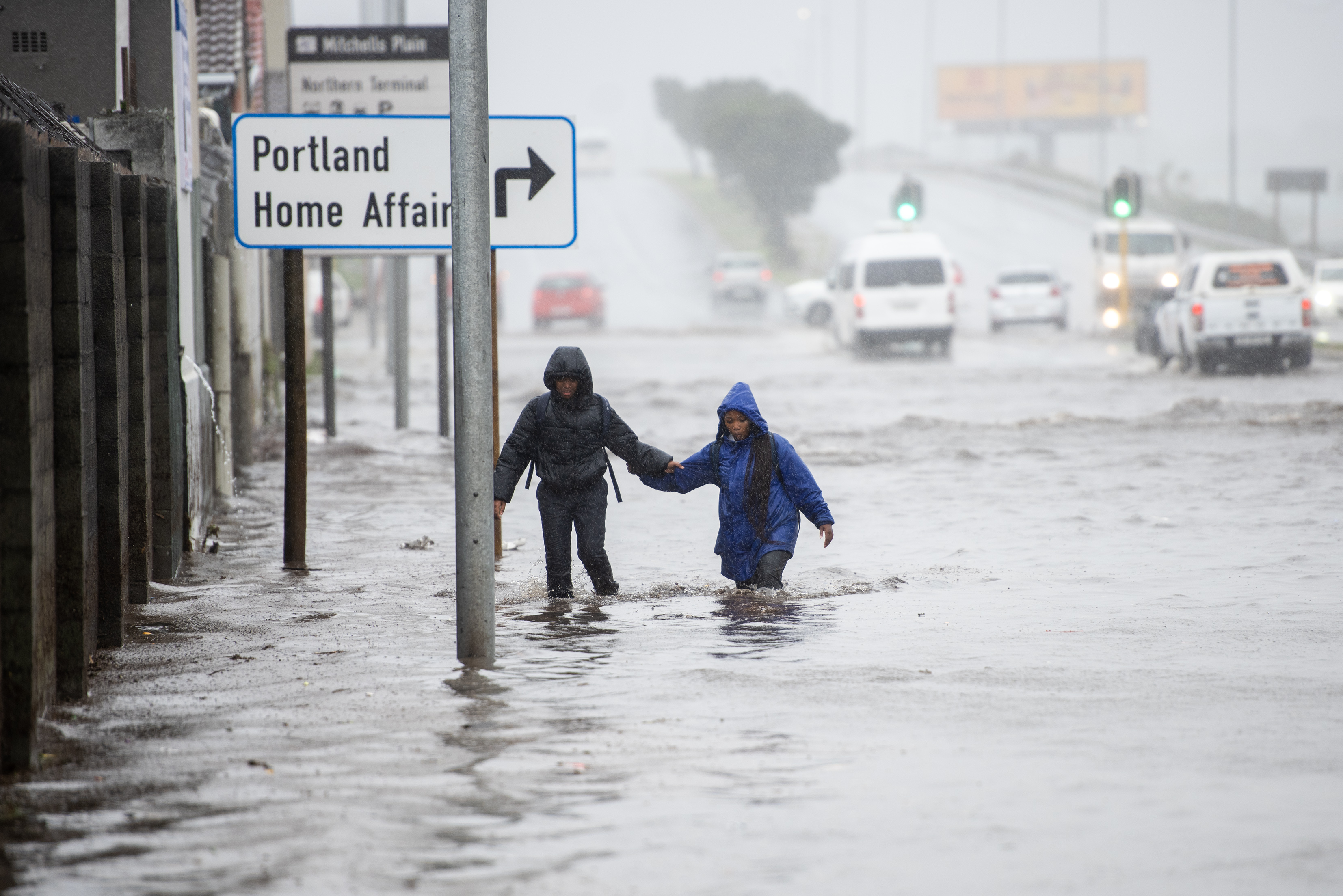
The storm caused widespread flooding, school closures, road washaways, and damage to more than 21,000 dwellings, with more than 83,000 people affected. Major routes were closed, including parts of the N1 and mountain passes. At least ten people died.
Cape Town has always experienced severe winter storms. But evidence increasingly suggests that extreme rainfall events are becoming more intense because a warmer atmosphere holds more moisture.
Southern Africa has recently seen several unusually destructive floods linked to climate variability and warming oceans.
There is an important distinction between a weather anomaly (a rare short-term event) and a climate shift (a long-term change in probabilities). The storm’s intensity and impacts fit a broader trend toward more damaging extreme-weather events.
The climatological jury is still out regarding the role of climate change in this particular storm. But climate change attribution studies have shown that climate change has intensified extreme rainfall events in many parts of the world.
This is because, as the earth warms, more water evaporates from warmer oceans into a warmer atmosphere, capable of holding more moisture. Hence, more rain can fall more quickly.
Current climate science for the southwestern Cape is nuanced: models often project fewer cold fronts overall, but warmer air can intensify rainfall during the strongest systems, and compound events (wind plus flooding and storm surge) may become more damaging.
The complicating factor is cut-off lows. The limited research available suggests they too may become less frequent, but the ones that do happen may carry more moisture, mirroring patterns seen in the Mediterranean (where Storm Daniel devastated coastal Libya in 2023).
The result, possibly, is a future of fewer storms but more extreme individual events, with longer dry spells between them.
Recent history is consistent with this: a relatively normal 2018–2021 period in the Western Cape was followed by a sharp spike in major extreme events from 2022 onwards, of which the May 2026 storm is the latest. In fact, in each of the last four years, there has been at least one month with extreme rainfall, where up to 300% of the long-term average monthly rainfall was recorded.
In future, cut-off lows are likely to become more unpredictable. Regions not usually affected may be hit. The impact on society may be different from what is expected. The severity of storms will become more difficult to predict, and weather warnings may become less accurate.
Heavy rainfall can also produce much greater human and economic damage than in earlier decades, because
Public reaction suggests many residents experienced this storm as unusually violent, especially the wind intensity. Being prepared for the next storm is a lofty ideal, as the storms are unpredictable in terms of location and intensity. Roads, water, power, and settlements are scattered, and building resilience on a provincial scale is a huge challenge. But it is a critical step towards preventing widespread and financially crippling damage.
While much of the larger and expensive responsibility lies with the various branches of government, there is much that members of the public can do to build resilience within their communities:
The City of Cape Town has developed natural disaster guides which are available on its website.
Agriculture – both rain-fed and irrigated crops – is especially vulnerable. Flooded fields delay planting, and overflowing riverbanks can wash away vineyards and orchards, as well as irrigation infrastructure. Transport of the harvest can also be affected by damaged roads and port delays.
Adapting and pre-empting extreme events is difficult, but some modifications, such as drainage trenches, river levees, dam wall reinforcement, and early warning systems, can assist.
Dr Johnston is an independent applied climatologist.