Hundreds of unique Cederberg place names rescued from potential extinction
Names like Slangbosfontein, Katstertdrif, Pendoornkraal, Sterrebosbank, Vogelgesang, Haasvlakte, and Jakkalskop
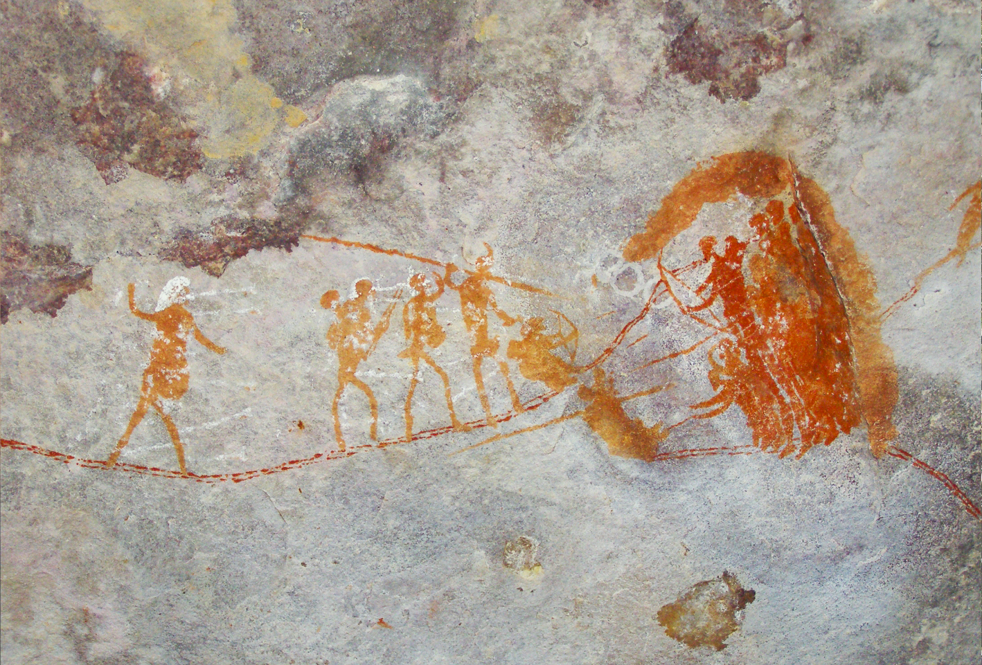
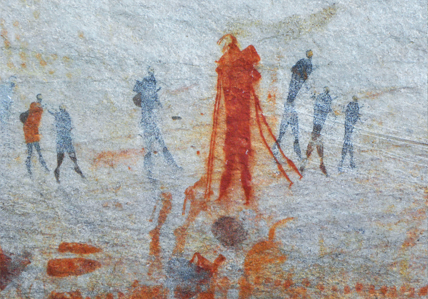
Rock art from Traveller’s Rest in the Agter-Pakhuis area of the Cederberg. It’s titled “Fight and Flight”, but author Peter Slingsby suggests it may depict something else – possibly a birthing scene. Photo: Peter Slingsby
‘What’s in a name?’ Shakespeare had his heroine ask in Romeo and Juliet. In a new book, local cartographer Peter Slingsby explains that vernacular place names are a crucial part of human heritage, and why it’s been so rewarding for him to map place names in the Cederberg.
For tens of thousands of years, the Cederberg mountain range of the Western Cape has cast its spell over people.
In response, they developed a rich lexicon of evocative vernacular names to describe their remote, tiny settlements, historic farms, a multitude of prominent geographical features and the highly diverse local flora that collectively made their region so unique.
Names like Slangbosfontein, Katstertdrif, Pendoornkraal, Sterrebosbank, Vogelgesang, Haasvlakte, and Jakkalskop.
Together, these and similar names would come to codify the Cederberg’s unique “Sense of Place” that is now a highly valued element of South Africa’s rich cultural and natural heritage.
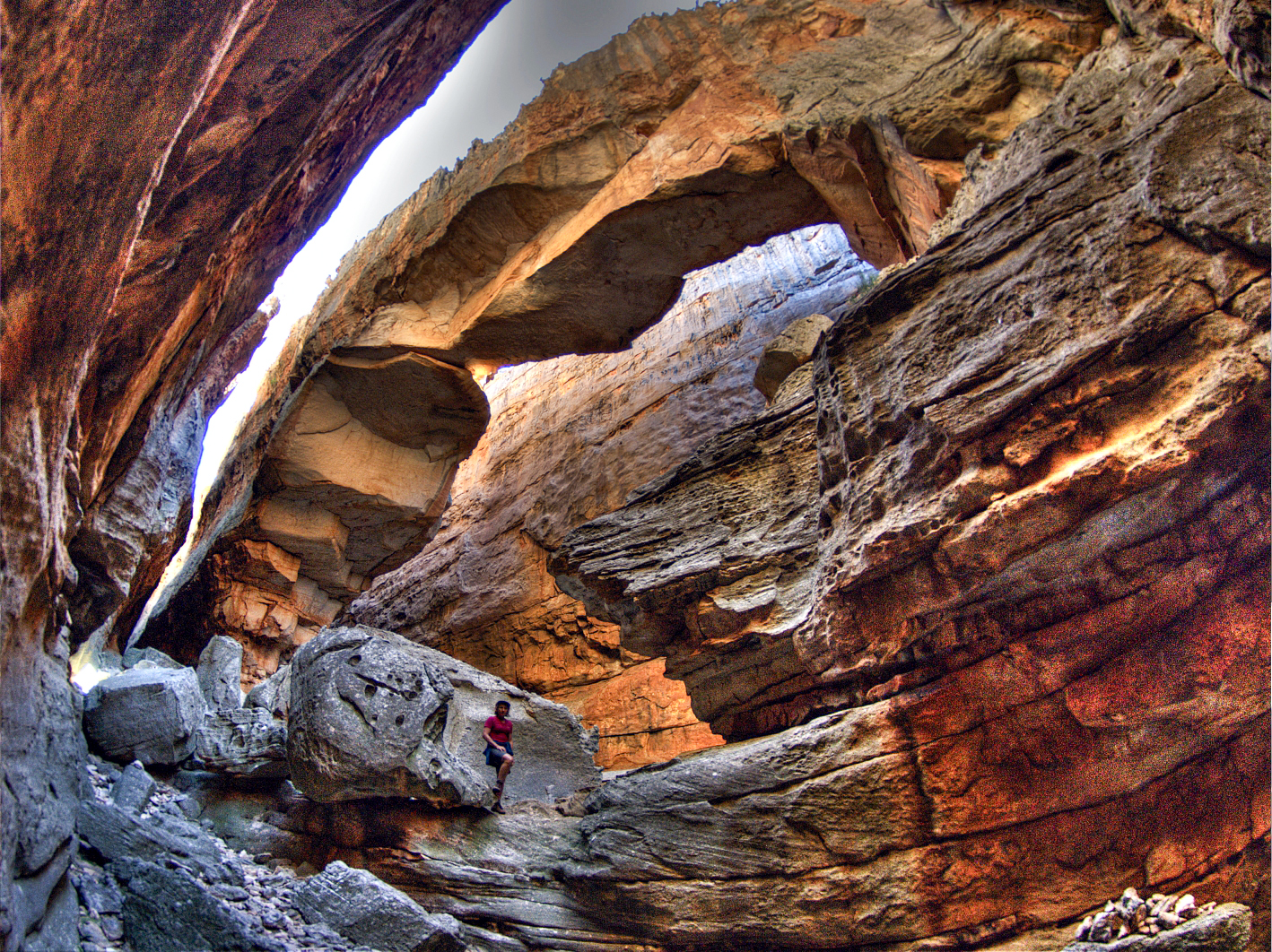
Inside the magnificent Wolfberg Cracks in the central Cederberg. Photo: Geoff Spiby
One man who has made a major contribution to popularising and protecting this heritage is 78-year-old Peter Slingsby. Best known as one of South Africa’s foremost cartographers, his body of work includes a popular series of maps covering hiking, tourism and nature destinations across the country that have become the go-to for nature-lovers, adventurers and tourists alike.
Of all the places he has charted, it’s the Cederberg that remains closest to his heart, ever since his first overnight experience as a 17-year-old hiking in the wild higher peaks of the range – a formative moment in his lifelong passion that led to many subsequent excursions, documenting, mapping and celebrating the region.
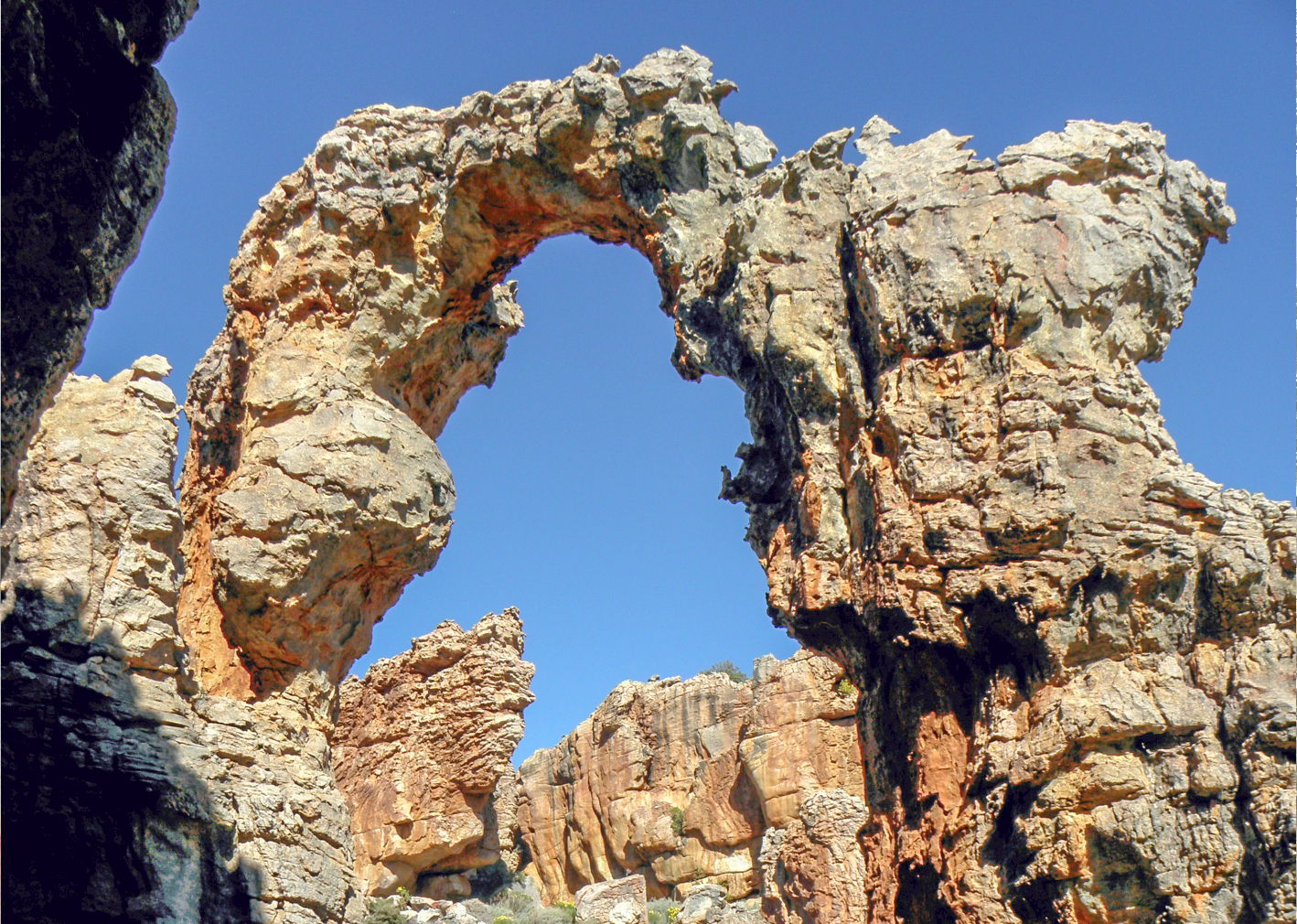
The impressive 20 metre Ereboog rock arch – its name means “wedding arbour”. Photo: Peter Slingsby
A crucial part of Slingsby’s contribution has been to record and curate hundreds of place names formerly known only in the oral tradition of small communities with very limited access to vehicles.
Slingsby describes this quest in his new book, which was launched earlier this month. “Place names and their meanings have always fascinated me. As a cartographer who has spent many fulfilling hours mapping the Cederberg, I’m unable to write about ‘Sense of Place’ without invoking the many – and often very beautiful – vernacular names that give frame and reference to anywhere frequented by human beings,” he says.
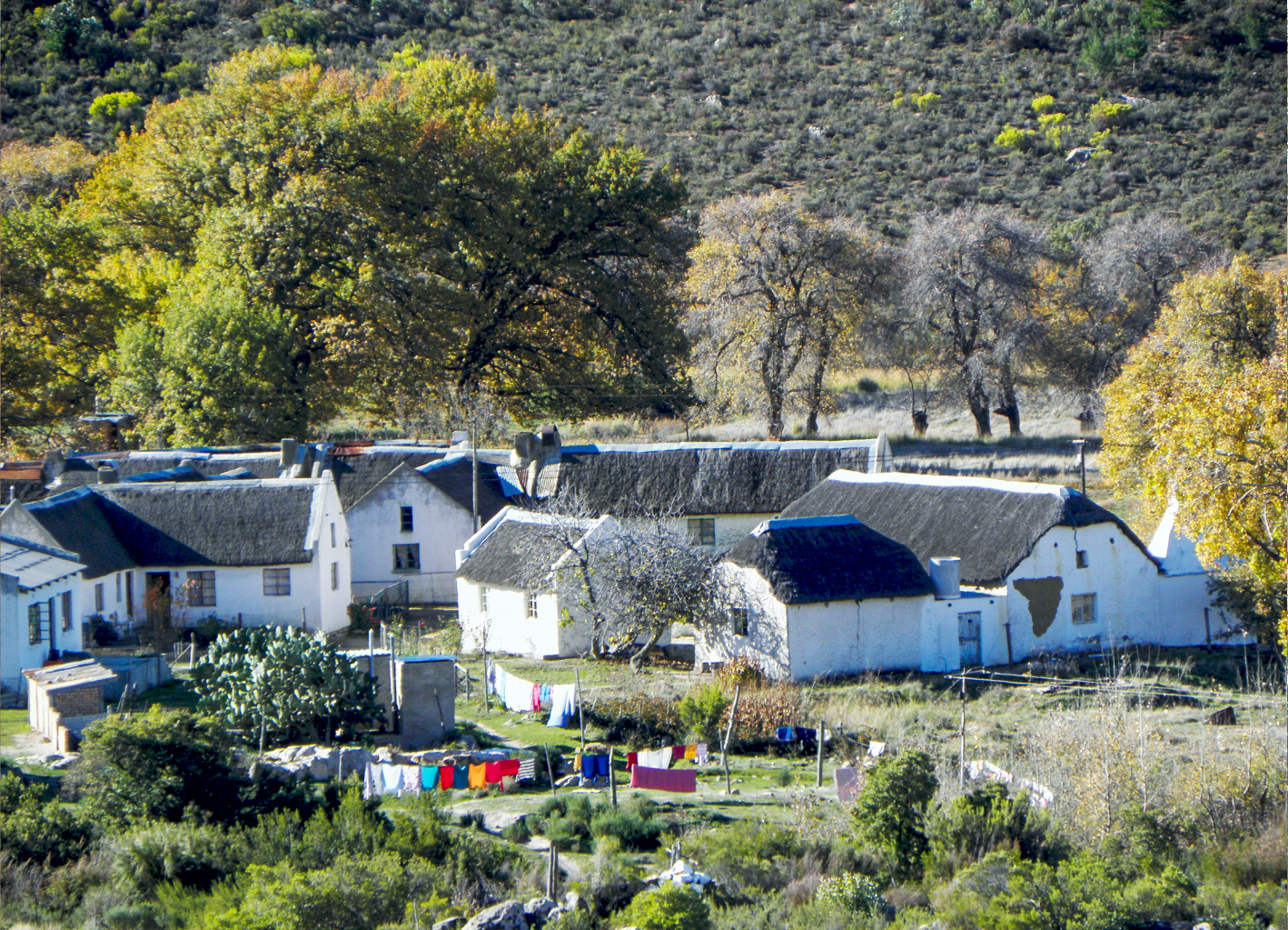
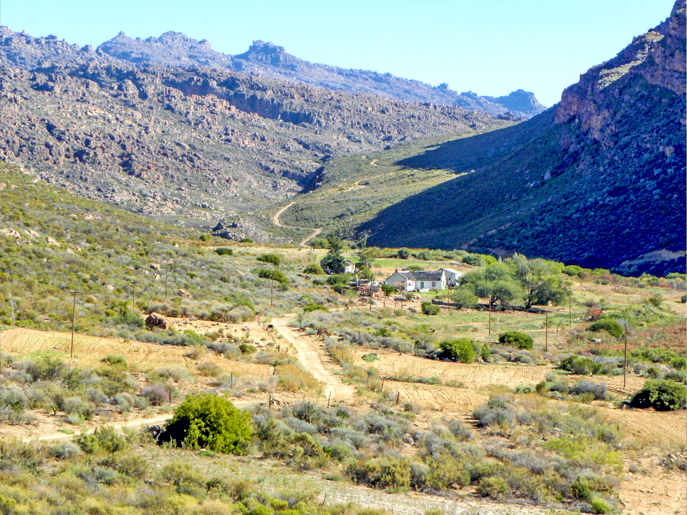
The small village of Heuningvlei, one of the outliers of the historic Wupperthal mission station. Photo: Peter Slingsby
The broad sweep of human history in the Cederberg started with the small groups of San (or /Xam) hunter-gatherers who were the sole human occupants of this region for perhaps as much as 30,000 years or more.
They left their legacy on the rock walls of caves, and in the genes of many thousands of South Africans, Slingsby says.
Author and cartographer Peter Slingsby at the famous Stadsaal rock formations in the Cederberg. Photo: Maggie Slingsby
The San’s sustainable existence was upended with the appearance of the Khoi herders some 2,000 years ago and then – dramatically more so – with the arrival of the Dutch and then the English colonists, starting in the mid-17th century.
Historically, this concentrated melting pot of human activity, language and biodiversity in a dramatic landscape produced a very rich vocabulary of vernacular place names. Sadly, most – particularly those of the San but also of the Khoi – have been forgotten, replaced or superseded by Dutch colonial names and later Afrikaans ones. It is a small solace that many of these latter names carry the same ancient meanings as the old languages, Slingsby adds.
The lovely Tratra River valley in the northern Cederberg. Photo: Peter Slingsby
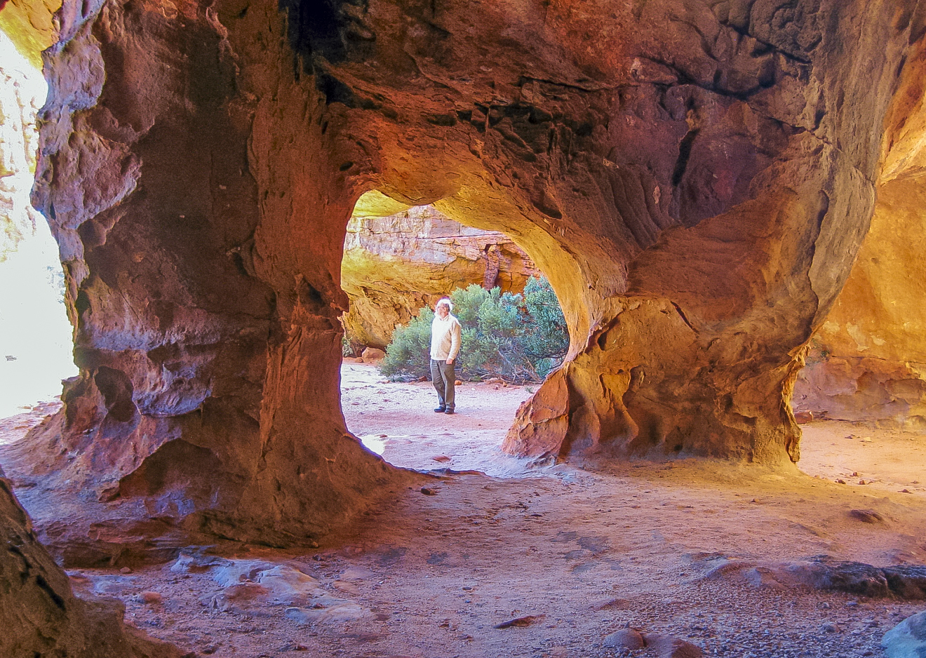
Several of the many dramatic, often other-worldly, geological features of the Cederberg have become household names: Stadsaal, Maltese Cross, Wolfberg Cracks, Wolfberg Arch, The Chockstone, Truitjieskraal, and Lot’s Wife.
Slingsby says that it is “extraordinary, unbelievable” that rocks like these form the heart of the Cederberg’s unique Sense of Place, with their enduring presence in the human imagination. But why were the names of some other elements in this landscape not also recorded on maps? Why were these known only through less reliable and vulnerable oral history?
This question came to the fore when a friend lent Slingsby a book published in 1989 by M.I. Murray titled Witwater se Mense [Whitewater’s People].
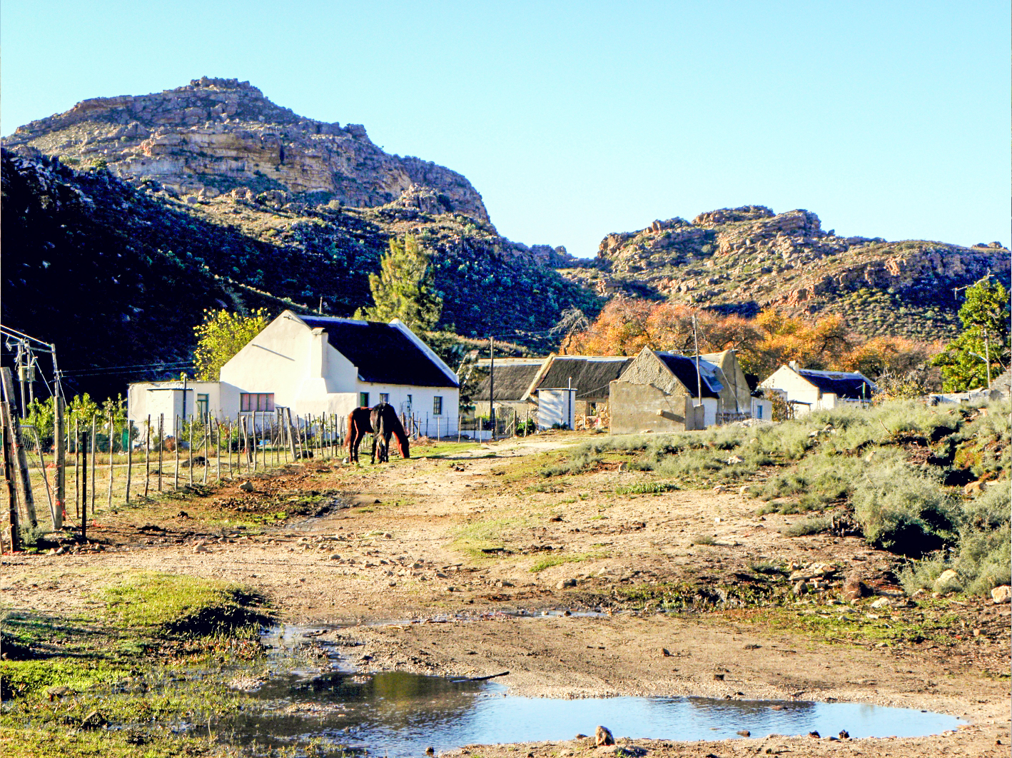
The tiny hamlet of Witwater in the Cederberg where many unique places names in the oral history were recorded for use on the Cederberg map. Photo: Peter Slingsby
Witwater is a tiny hamlet that together with its only slightly bigger neighbour, Heuningvlei, are two outliers of the historic Moravian Church (initially the Rhenish Church) mission station settlement of Wupperthal in the northern Cederberg.
The book is an “utterly engrossing” tale of a young girl’s life in Witwater, recounted to Murray by her domestic servant, Slingsby explains. But what really piqued his interest was that it contained many place names that didn’t feature on any existing maps.
Intrigued as to whether these names were real or fictional, Slingsby and his wife Maggie went to Heuningvlei where they met five or six village elders. “I showed them the list of names that I’d culled from the book, but one by one they shook their heads. ‘Nee,’ they said, ‘ons ken nie daai name nie.’ [No, we don’t know those names.] We were very disappointed,” he writes.
But suddenly one of the elders, the late Joey Ockhuis, had a lightbulb moment and exclaimed: “Ek ken daai name! Dis almal Witwater se name!” [I know those names! They’re all Witwater’s names!]
Slingsby recounts this part of the story with his characteristic dry wit: “Heuningvlei is a whole six kilometres from Witwater; why on earth should we expect the Heuningvleiers to recognise Witwater’s names? If you live in Claremont, why should you know anything about Rondebosch?
“It was such a wonderful moment, and they all nodded ‘O, ja!’”.
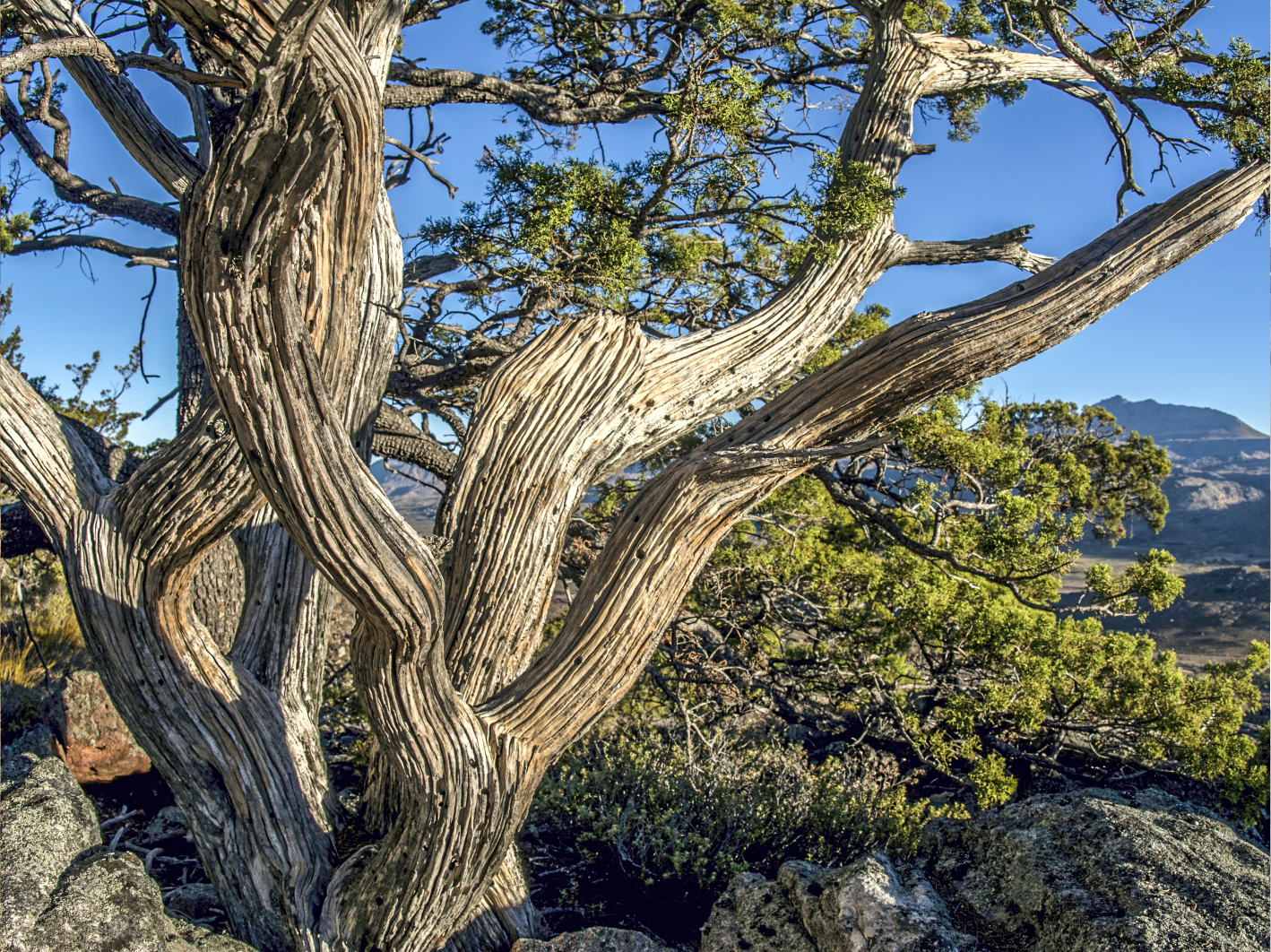
One of the cedar trees Widdringtonia cedarbergensis that has given its name to the Cederberg region. Photo: Geoff Spiby
After collecting as many names as possible from Heuningvlei, Slingsby went to Witwater and the surrounding area where other elders pointed out not only every name mentioned in Murray’s book but, to Slingsby’s delight, many others as well.
“We collected nearly two hundred names that day, names that had never been on maps before, names that would be lost forever if they were not recorded – including Sitkoppie, Brandysterklip, Kerniekelsfontein, Giel se Knik and, reflecting the ancient myths of the area, Watermense se gat,” he recalls.
More than 150 “new” old names were pointed out by other elders during follow-up visits – names like Kloekie se Klip, Santjie se Werf, Bokdrif and Skoenmakerspoort.
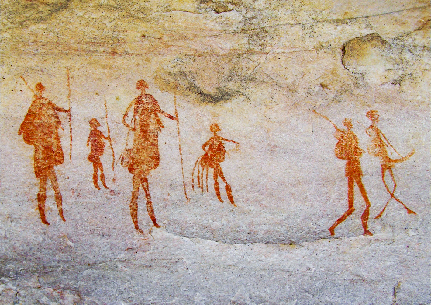
Rock art from Fallen Rock Cave, Bushmans Kloof Lodge in the Cederberg. Photo: Peter Slingsby
The key to uncovering this trove of names was taking time to appreciate the experiences of people without motorised transport, Slingsby explains.
“When everyone is driving around, place names get forgotten because they’re not really needed any longer. But when you live without a vehicle, you know the name of every landmark. Every corner, every hill, every bend … everything is a place to you. You see everything, it’s like walking a trail. And that’s what I’ve tried to do with all my trail maps. A map needs to have place names to be useful.”
When the first edition of Slingsby’s Cederberg map was published in 2013, it contained close to 300 “new” place names. By the time the current 5th edition appeared late in 2024, it included close to 500 names never previously recorded on maps.
“There’s a very important reason why names should be on maps,” Slingsby insists. “Rather like a written history of events, it’s ultimately the only way that place names get properly remembered.”
Rock art from Traveller’s Rest in the Agter-Pakhuis area of the Cederberg. Photo: Peter Slingsby
Support independent journalism
Donate using Payfast
![]()
Don't miss out on the latest news
We respect your privacy, and promise we won't spam you.
Letters
Dear Editor
What an amazing article highlighting the incredibly important work done by Mr Slingsby in reporting and protecting the real South African heritage and history.
I am going to get this book at Paarl today.
This is the culture and heritage which is so sorely needed in the Western Cape, and I am wondering that perhaps like the more famous Camino, that perhaps a Khoisan trail throughout Western Cape and perhaps as far as Eastern Cape and Lesotho, might be a great way of attracting tourists and recognising our unwritten, verbal history.
I believe this is significant in both South African, but also in world /African perspective and could become a central focus on the increasingly important cultural tourism.
© 2025 GroundUp. This article is licensed under a Creative Commons Attribution-NoDerivatives 4.0 International License.
You may republish this article, so long as you credit the authors and GroundUp, and do not change the text. Please include a link back to the original article.
We put an invisible pixel in the article so that we can count traffic to republishers. All analytics tools are solely on our servers. We do not give our logs to any third party. Logs are deleted after two weeks. We do not use any IP address identifying information except to count regional traffic. We are solely interested in counting hits, not tracking users. If you republish, please do not delete the invisible pixel.